Using Tableau’s Spatial Joins with Mixed Geometries
この記事は公開されてから1年以上経過しています。情報が古い可能性がありますので、ご注意ください。
Introduction:
It is possible to create spatial joins using different spatial data sources in Tableau. This also means Tableau supports joining mixed geometries. For example, think of joining a geometric line data source with another data source containing a mixture of points and polygon. This feature of combining mixed geometries which could be joined in Tableau is very helpful. Let us consider a practical example in this post.
How to Achieve it:
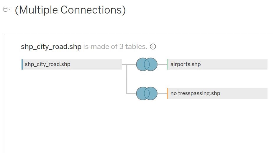
Consider three different spatial datasets such as:
1) Line geometry for data containing roads in Kagoshima city,
2) Point geometry for various airports in Kagoshima and
3) Polygon geometry showing no trespassing zone around Sakurajima volcano.
A representation of these datasets are shown in Tableau maps below.


Using Tableau, join all these three datasets using physical joins, with the condition of full outer join with intersecting geometries. This ensures that all the geo data from three datasets is captured and combined into a single larger dataset. A representation of the physical data join is shown below.
Finally to combine all the geometries, add them as different layers in a map as shown below.

Thus, a full outer join with mixed geometries is possible in Tableau and the combined output can be used to create a desired map in Tableau.
Summary:
It is possible to join multiple mixed geometric data files in Tableau to have a better mapping experience.