Spatial Data Analysis in Tableau Prep
この記事は公開されてから1年以上経過しています。情報が古い可能性がありますので、ご注意ください。
Introduction:
There is a major advancement in Tableau Prep which can now handle and process spatial data ! Tableau Prep Builder can now import, recognize, and export spatial data to extracts and published data sources, bringing spatial context into the data preparation flow for better analysis. Let us consider an example to demonstrate this.
How to Achieve Spatial Analysis in Tableau Prep:
Let us say we have a shape file which defines the point geometry of the famous beaches in Oahu, Hawaii. We also have another shape file which shows locations of Hotels in Hawaii and we want to combine those data points to display a map. By using Tableau Prep it is now possible to combine such two datasets so as to overlay the beaches and hotels in a single output file.


Similarly, if we have two (or even more) spatial files with a line geometry, such as one containing the hiking trails and the other displaying bikeways, then it is easily possible to union those using Tableau Prep and the superimposed data can be used for further analysis.


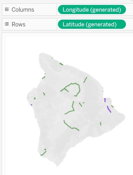
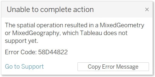
It is important to note that, currently Tableau Prep does not allow mixed geometries. Data to be processed must contain homogenous geometric shapes such as only lines, or only points or only polygons etc.
In this example, the beach data is obtained from Google maps and the rest of the data (bikeways, trails and hotel) can be accessible as a shape file from the Hawaii government’s website.
Summary:
Tableau Prep now allows spatial data analysis. As mixed geometries are not supported yet, users should be able to do various spatial data analysis containing uniform geometries.